Why linked data?
Linked Data is a method of structuring and interconnecting data on the web, enabling seamless navigation and exploration of diverse information sources. It uses standard web protocols and technologies to create a global data ecosystem where data elements are linked to related data, allowing for easier discovery, retrieval, and integration.
In the face of challenges brought by the Russian-Ukrainian conflict, our project leverages the power of Linked Data to unify and enrich geo-annotated event datasets. This innovative approach not only aids in integrating critical information sources but also lays the foundation for more effective resilience projects in Ukraine and other war-related cases. Join us on this journey of data transformation and discover how Linked Data can be applied for societal impact and positive change.

What is our project?
Our analysis uncovered significant data format variations in reported events, largely due to the lack of standardized vocabularies and ontologies. To address this, we applied popular ontologies like Schema.org, Dublin Core, Simple Event Ontology, and GeoNames for consistent geo-information representation.
- Converting
- Enriching
- Multilingual
- Integrating
- Publishing
- Visualizing
Using linked data we were able to transform war events collected for EyesOnRussia and Civilian Harm into RDF triples enabling the data to be linked with semantic meanings. Each event was assigned a URI, categorized as 'Event,' and linked with a date province, city, and postal code in triples format
We inferred missing data and enriched the dataset with additional information. For example, the postal code is retrieved by calling GeoNames' APIs. Also, missing cities and provinces were retrieved utilizing coordinates. Difficulties due to spelling errors and multilingual cases were manually resolved.
Multilinguality was improved in the integrated dataset with the addition of multilingual labels, including French, Ukrainian, Dutch, and German. This results in a multilingual dataset for multi-national aid to Ukrainian organizations.
We designed a pipeline of data integration and the resulting integration was verified by volunteers. We implemented an algorithm to verify the proximity criteria based on a set of parameters. Identified 206 event pairs that need to be merged, each associated with a new event URI representing their integration. We introduce a hasPrimarySource relation for the event with richer information.
We published our converted and enriched version of the datasets on TriplyDB platform, our integrated dataset is also published but only available upon request due to privacy reasons.
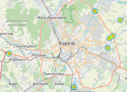
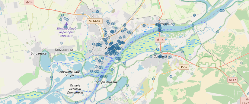
TriplyDB features allowed us to visualize our use cases by executing SPARQL Queries we were able to showcase the benefits of our datasets, e.g. visualizing events locations on a map and plotting graphs